
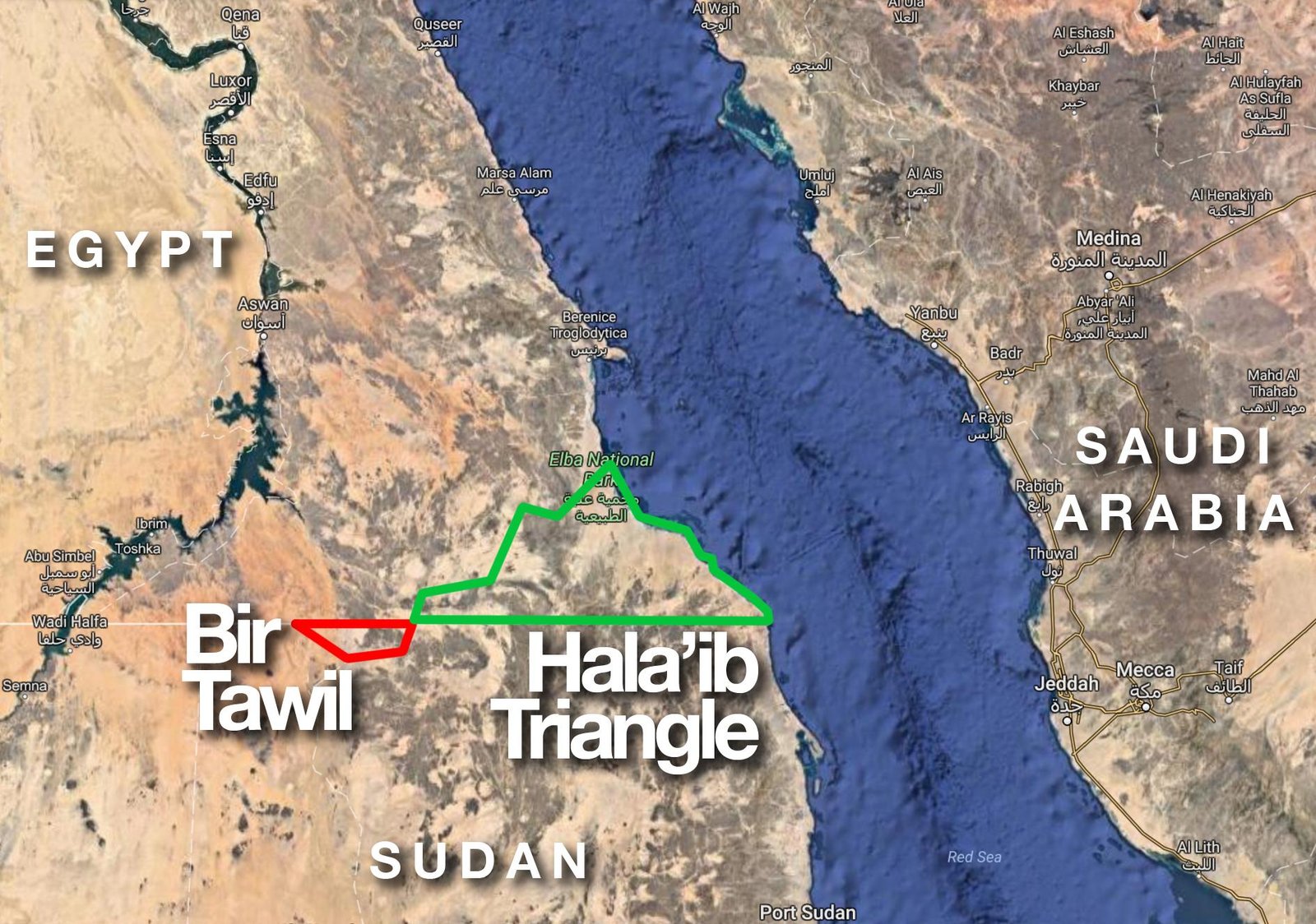
There is a strange piece of land in northeastern Africa that appears on maps between Egypt and Sudan, yet neither country officially claims it. It is called Bir Tawil.Covering approximately 2,060 square kilometers (795 square miles), the remote desert contains rocky mountains, sand, and almost no permanent population. Its unusual political status dates back more than a century.
In 1899, Britain established a political boundary between Egypt and Sudan along the 22nd parallel. Under that arrangement, Bir Tawil fell on the Sudanese side while the much larger Hala’ib Triangle was associated with Egypt.Then, in 1902, British authorities created a different administrative boundary. This placed Bir Tawil on the Egyptian side while putting the Hala’ib Triangle under Sudanese administration.
That created a remarkable geopolitical puzzle.
Egypt and Sudan both claim the Hala’ib Triangle, which has access to the Red Sea and is considerably more valuable strategically and economically. But their preferred interpretations of the historical boundaries leave Bir Tawil outside their respective claims.
As a result, neither government officially treats Bir Tawil as its sovereign territory. The area is therefore often described as terra nullius, meaning land belonging to no state.
That doesn’t mean nobody has ever tried to claim it. Over the years, individuals have traveled there and proclaimed tiny “kingdoms” or countries, sometimes hoping to gain attention online. None of these personal claims has been recognized internationally.